Jump to content
IMPORTANT ANNOUNCEMENT ABOUT LOGGING IN ×
  • WELCOME GUEST

    It looks as if you are viewing PalmTalk as an unregistered Guest.

    Please consider registering so as to take better advantage of our vast knowledge base and friendly community.  By registering you will gain access to many features - among them are our powerful Search feature, the ability to Private Message other Users, and be able to post and/or answer questions from all over the world. It is completely free, no “catches,” and you will have complete control over how you wish to use this site.

    PalmTalk is sponsored by the International Palm Society. - an organization dedicated to learning everything about and enjoying palm trees (and their companion plants) while conserving endangered palm species and habitat worldwide. Please take the time to know us all better and register.

    guest Renda04.jpg

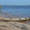
Comparion of high water to low water


amazondk

Recommended Posts

We have just entered the dry season here on the south side of the equator. This year was an all time record season flood with the water level surpasing the previous high water mark set in 1953 reaching 29,71 meters above sea level at the port of Manaus. The river has now dropped about 50 cms from that point. I stopped by the Ponta Negra and took a picture today to compare the river to it´s level during the dry season. I took the first picture a few years ago and I do not know the actual date, but it was during the peak of the low water period. The beach is quite large during this time. And, it visited a lot by locals. The normal difference from low to high water is about 15 meters or so. It is a lot of water. The Negro River is the largest tributary of the Amazon the worlds largest and now considered longest river. The Tropical Business hotel is the building on the point.

praiadapontanegra1ja.jpg

People still go swiming in the high water. But, instead of the beach they just jump off the containment wall. The river at this point is about 8 kms across and at the deepest point about 90 meters deep. It is a lot of water.

RioNegroJuly28-1.jpg

Don Kittelson


LIFE ON THE RIO NEGRO

03° 06' 07'' South 60° 01' 30'' West

Altitude 92 Meters / 308 feet above sea level

1,500 kms / 932 miles to the mouth of the Amazon River


Manaus, Amazonas, Brazil - A Cidade da Floresta

Where the world´s largest Tropical Rainforest embraces the Greatest Rivers in the World. .

82331.gif


Click here to visit Amazonas

amazonas2.jpg

Link to comment
Share on other sites

Wow I could've sworn there was a beach here somewhere??? lol.

Great pics Don. I also like to see how boats become beached whenever low tide hits some of the bays here. Places that were about 4 feet under water suddenly become dry!

Michael Ferreira

Bermuda-Humid(77% ave), Subtropical Zone 11, no frost

Warm Season: (May-November): Max/Min 81F/73F

Cool Season: (Dec-Apr): Max/Min 70F/62F

Record High: 94F

Record Low: 43F

Rain: 55 inches per year with no dry/wet season

Link to comment
Share on other sites

Amazing shots Don! You are right about that being a lot of water! Good lord. Also, the water appears clean in both images. If we have a big flood, the water is usually full of silt.

Land O Lakes FL, a suburb on the North Side of Tampa, FL

Summers are great, 90f/32c in the day & 70f/21c at night with plentiful rain & sun

Winters are subtropical with occasional frosts and freezes. Tropical cyclones happen.

We have a few Royal palms in the warm microclimates but Coconuts freeze.

I am a Kayaker, Hiker, Bicyclist, and amateur Photographer that loves the outdoors.  

Link to comment
Share on other sites

That's some amazing pics Don.

Best regards

Tyrone

Millbrook, "Kinjarling" Noongar word meaning "Place of Rain", Rainbow Coast, Western Australia 35S. Warm temperate. Csb Koeppen Climate classification. Cool nights all year round.


Link to comment
Share on other sites

Wow Don,

The amazon is amazing, and that water level change is incredible! The amazon is truly one of the top wonders of the world, giving rise to such a high percentage(40%?) of the worlds plant and animal life. Hopefully someday I can make it there and see it in person.

Tom

Formerly in Gilbert AZ, zone 9a/9b. Now in Palmetto, Florida Zone 9b/10a??


Tom Blank

Link to comment
Share on other sites

The river is on it´s way down now. From now until the end of October it should drop at least 14 meters. The Negro River never gets muddy. Although some of the tributaries are muddy water rivers, like the Rio Branco which comes from Roraima, the river is too big and just absorbs the silt. The seasonal flood is a slow process starting in the begining of November and ending somewhere around the end of June every year. The two factors impacting the water level are the amount of rain over the watershed, which stretches up to Colombia, and the amount of water in the Amazon which acts as a dam at the mouth of the Negro. This year the Amazon River was also at record high water levels which impacted the amount of water held in the Negro.

These pictures taken off the bluff in front of my place at Paricatuba give a pretty good idea of the water levels as well. They were taken at pretty much the same spot one the end of October and the other one the middle of June.

151220071117.jpg

BelaVistaRiverJuly19.jpg

Don Kittelson


LIFE ON THE RIO NEGRO

03° 06' 07'' South 60° 01' 30'' West

Altitude 92 Meters / 308 feet above sea level

1,500 kms / 932 miles to the mouth of the Amazon River


Manaus, Amazonas, Brazil - A Cidade da Floresta

Where the world´s largest Tropical Rainforest embraces the Greatest Rivers in the World. .

82331.gif


Click here to visit Amazonas

amazonas2.jpg

Link to comment
Share on other sites

Here are a couple of other pictures of the river at Paricatuba. They are basically from the same place but the angle is a bit different from one to the other.

BVigapo02sept2008.jpg

IgapoBVJul19.jpg

Don Kittelson


LIFE ON THE RIO NEGRO

03° 06' 07'' South 60° 01' 30'' West

Altitude 92 Meters / 308 feet above sea level

1,500 kms / 932 miles to the mouth of the Amazon River


Manaus, Amazonas, Brazil - A Cidade da Floresta

Where the world´s largest Tropical Rainforest embraces the Greatest Rivers in the World. .

82331.gif


Click here to visit Amazonas

amazonas2.jpg

Link to comment
Share on other sites

Create an account or sign in to comment

You need to be a member in order to leave a comment

Create an account

Sign up for a new account in our community. It's easy!

Register a new account

Sign in

Already have an account? Sign in here.

Sign In Now


  • Recently Browsing

    • No registered users viewing this page.
×
×
  • Create New...