Jump to content
IMPORTANT ANNOUNCEMENT ABOUT LOGGING IN ×
  • WELCOME GUEST

    It looks as if you are viewing PalmTalk as an unregistered Guest.

    Please consider registering so as to take better advantage of our vast knowledge base and friendly community.  By registering you will gain access to many features - among them are our powerful Search feature, the ability to Private Message other Users, and be able to post and/or answer questions from all over the world. It is completely free, no “catches,” and you will have complete control over how you wish to use this site.

    PalmTalk is sponsored by the International Palm Society. - an organization dedicated to learning everything about and enjoying palm trees (and their companion plants) while conserving endangered palm species and habitat worldwide. Please take the time to know us all better and register.

    guest Renda04.jpg

Flying Down The Amazon RiverI


amazondk

Recommended Posts

I went on a little business trip to Parintins yesterday.  Parintins is the host of the yearly folk festival the last three days of June which draws a crowd as big as the city.  The city has about 125,000 inhabitants and the festival receives about this number people to see the show and participate in the party.  Parintins is on the island of Tupinabarana which runs along the south side of the Amazon River.  The area was actually colonized by Tupi indians which moved in fleeing due to pressure from the Europeans in other parts of colonial Brazil hundreds of years ago.  The city lies on the Varzea, or flood plane of the Amazon.  It has been raining a lot here which you can sort of see by the pictures.  The Amazon River spreads out over an enormous area with many channels and lakes.  This time of year the river is about half way up to high water which comes in June.  The two groups for the festival have the colors Red (Garantido) and Blue (Caprichoso).  The city is split into two sides one with buildings and house painted blue and white to a large degree and the other side red and white.  Aside from the festival cruise ships that come up to Manaus stop for shows which are given by one of the two Bois.  There are not a lot of palms, but I figured some of you would like to see what the area looks like.

I left Manaus at 0700 on an EMB 120 Brasilia for the 1 hour flight down the Amazon River to Parintins.

EMB120DowntheAmazon.jpg

The main channel of the Amazon River, in places it is 300 feet deep and ocean going vessels travel with no problem.

AmazonbyentradaparaRamos.jpg

There are thousands of lakes formed as the river floods in its annual rise and fall.  

AmazonMainchannel.jpg

Don Kittelson


LIFE ON THE RIO NEGRO

03° 06' 07'' South 60° 01' 30'' West

Altitude 92 Meters / 308 feet above sea level

1,500 kms / 932 miles to the mouth of the Amazon River


Manaus, Amazonas, Brazil - A Cidade da Floresta

Where the world´s largest Tropical Rainforest embraces the Greatest Rivers in the World. .

82331.gif


Click here to visit Amazonas

amazonas2.jpg

Link to comment
Share on other sites

As we descended for arrival in Parintins the varzea is seen from closer up.  The pockets of light green are Vitoria Regia lilies growing in ponds.

VarzeaPIN.jpg

The channels are all around the island.  This is not the main channel of the Amazon River.

VazeaarrvingPIN.jpg

The area of the varzea is used for cattle pasture until the water gets too high and the livestock is then moved to high ground.  Until a few years ago the area was used to grow jute for rope and burlap sacks.  But, due to the introduction of synthetics this crop has nearly disappeared.

Tupinabarana.jpg

Don Kittelson


LIFE ON THE RIO NEGRO

03° 06' 07'' South 60° 01' 30'' West

Altitude 92 Meters / 308 feet above sea level

1,500 kms / 932 miles to the mouth of the Amazon River


Manaus, Amazonas, Brazil - A Cidade da Floresta

Where the world´s largest Tropical Rainforest embraces the Greatest Rivers in the World. .

82331.gif


Click here to visit Amazonas

amazonas2.jpg

Link to comment
Share on other sites

Arrival in Parintins on the Rico Brasilia complete with a Japanese tourist taking a picture of me taking a picture of him.

ArrivalPINRico.jpg

PIN airport terminal

TerminalPIN.jpg

The river bank looking west up the Amazon River.

Beira.jpg

The old municpal market downtown

MercadoPIN.jpg

Don Kittelson


LIFE ON THE RIO NEGRO

03° 06' 07'' South 60° 01' 30'' West

Altitude 92 Meters / 308 feet above sea level

1,500 kms / 932 miles to the mouth of the Amazon River


Manaus, Amazonas, Brazil - A Cidade da Floresta

Where the world´s largest Tropical Rainforest embraces the Greatest Rivers in the World. .

82331.gif


Click here to visit Amazonas

amazonas2.jpg

Link to comment
Share on other sites

I got done with my busness meeting ahead of schedule, by 1100 and did not have anything else to do so I went to a local hotel and got a day room.  This is the Amazon River Hotel.  It is pretty empty out of season, so I got a good deal.

PoolAmazonRiverHotel.jpg

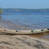
The view out of the room, this is a channel that cuts through the city in high water.

LagoPIN-2.jpg

Export lumber shipment - well not quite.  

Exportlumber.jpg

Don Kittelson


LIFE ON THE RIO NEGRO

03° 06' 07'' South 60° 01' 30'' West

Altitude 92 Meters / 308 feet above sea level

1,500 kms / 932 miles to the mouth of the Amazon River


Manaus, Amazonas, Brazil - A Cidade da Floresta

Where the world´s largest Tropical Rainforest embraces the Greatest Rivers in the World. .

82331.gif


Click here to visit Amazonas

amazonas2.jpg

Link to comment
Share on other sites

My flight was scheduled to return back to Manaus at 430 PM, but it got delays for 3 hours.  So, I took a few more pictures.  

These are some Roystoneas which I believe were planted on this farm by a side channel of the Amazon.

Roystoneasbyriver.jpg

And, the daylight went away with another Amazonian Sunset with a couple tucuma (Astrocaryum vulgare) on the horizon.     Just another day in the Tropics.

Sunset.jpg

Don Kittelson


LIFE ON THE RIO NEGRO

03° 06' 07'' South 60° 01' 30'' West

Altitude 92 Meters / 308 feet above sea level

1,500 kms / 932 miles to the mouth of the Amazon River


Manaus, Amazonas, Brazil - A Cidade da Floresta

Where the world´s largest Tropical Rainforest embraces the Greatest Rivers in the World. .

82331.gif


Click here to visit Amazonas

amazonas2.jpg

Link to comment
Share on other sites

Dear Don  :)

the stills are terrefic & its clear that you travel a lot_

Way to Go !

Hey what work do you do & are you working for any News

agency or so like API ,Rauiters etc.because the stills are

simply fentastic_man. :)

Saying_"nobody covers the globe as we do"_British Airways Slogan.

New Slogan_"Nobody covers R.Amazon as you do"_ Don.

Another Solgan_"Nobody does it better than you do"_007 Song

But is also apt to your stills.

Thanks for those Aviation stills.

Love,

Kris(India).

love conquers all..

43278.gif

.

Link to comment
Share on other sites

I always look forward to seeing your pictures.  I hope to see some of these places in person someday. Thanks.

South Florida

Link to comment
Share on other sites

Don,

As always, enjoyed the journey very much. Almost like being there! :)  

And that's a great shot of the Brasilia. It would definitely qualify to be on some of the aviation sites I know of. And had to check the background of that particular aircraft...: one of the early Brasilias (s/n 120041, i.e. aircraft #41), almost 20 years old. Initially flew for a German airline, then for Midway Commuter in the U.S. Midwest and came "back home" to Brazil 15 years ago. Looks like it's still in good shape!

Bo-Göran

Leilani Estates, 25 mls/40 km south of Hilo, Big Island of Hawai'i. Elevation 880 ft/270 m. Average rainfall 140 inches/3550 mm


Link to comment
Share on other sites

Kris,

Thanks for the comments.  As to work I broker hardwood export sales mostly to Europe.  It is kind of fun to record some of the daily events of a business trip.  And, looking around at palms makes it better.

Mike, I am glad you enjoy the photos.  I hope you can come and see the place for yourself some day.  There are daily flights from Miami, only 5 hours away.

Bo,

Thanks a lot for the history of the airplane.  They really are not bad aircraft for short trips like this one.  It is interesting to know the background of a plane.  

dk

Don Kittelson


LIFE ON THE RIO NEGRO

03° 06' 07'' South 60° 01' 30'' West

Altitude 92 Meters / 308 feet above sea level

1,500 kms / 932 miles to the mouth of the Amazon River


Manaus, Amazonas, Brazil - A Cidade da Floresta

Where the world´s largest Tropical Rainforest embraces the Greatest Rivers in the World. .

82331.gif


Click here to visit Amazonas

amazonas2.jpg

Link to comment
Share on other sites

Don, I always appreciate and look foward to your posts. Very informitive and interesting pictures that I always enjoy!! Thank you very much for showing us a part of the world that we all are very interested in and someday I hope to visit!!

Dave Hughson

Carlsbad, Ca

1 mile from ocean

Zone 10b

Palm freaks are good peeps!!!!!

Link to comment
Share on other sites

(Zac in NC @ Jan. 19 2007,14:04)

QUOTE
Great set of pics Don. Stereotypical Japanese tourist with a camera. LOL

Zac

Zac,

Caught on camera by non stereotypical gringo businessman and forest exporer.

dk

Don Kittelson


LIFE ON THE RIO NEGRO

03° 06' 07'' South 60° 01' 30'' West

Altitude 92 Meters / 308 feet above sea level

1,500 kms / 932 miles to the mouth of the Amazon River


Manaus, Amazonas, Brazil - A Cidade da Floresta

Where the world´s largest Tropical Rainforest embraces the Greatest Rivers in the World. .

82331.gif


Click here to visit Amazonas

amazonas2.jpg

Link to comment
Share on other sites

Dave,

I hope you can make it down some day.  I am sure you will enjoy the place.  I do for sure.

dk

Don Kittelson


LIFE ON THE RIO NEGRO

03° 06' 07'' South 60° 01' 30'' West

Altitude 92 Meters / 308 feet above sea level

1,500 kms / 932 miles to the mouth of the Amazon River


Manaus, Amazonas, Brazil - A Cidade da Floresta

Where the world´s largest Tropical Rainforest embraces the Greatest Rivers in the World. .

82331.gif


Click here to visit Amazonas

amazonas2.jpg

Link to comment
Share on other sites

(amazondk @ Jan. 19 2007,17:16)

QUOTE

(Zac in NC @ Jan. 19 2007,14:04)

QUOTE
Great set of pics Don. Stereotypical Japanese tourist with a camera. LOL

Zac

Zac,

Caught on camera by non stereotypical gringo businessman and forest exporer.

dk

It makes you wonder. Will you be posted by said stereotypical Japanese guy on some Japanese Travel message board?

Zac

Zac  

Living to get back to Mexico

International Palm Society member since 2007

http://community.webshots.com/user/zacspics - My Webshots Gallery

Link to comment
Share on other sites

Don,

 Once again you have shared some beautiful sights with us all. I can tell you honestly, I hope the biennial in 2010 is held in Brazil. I look forward to coming.

Jeff

Searle Brothers Nursery Inc.

and The Rainforest Collection.

Southwest Ranches,Fl.

Link to comment
Share on other sites

Thanks Jeff I am glad you like the pictures.  I enjoy showing people what our area looks like.  Even though Amazonia gets a lot of media attention many people here in Brazil and elsewhere really do not know much about the area.  It would nice to have a biennial here in Brazil.  There are a lot of nice places where one could be held for sure, it is a big tropical country with a lot of palm trees.  And, since it seems that many of the attendees at the meetings like cold beer, which is never in short supply in Brazil, and local dancing clubs it would be a popular destination .

dk

Don Kittelson


LIFE ON THE RIO NEGRO

03° 06' 07'' South 60° 01' 30'' West

Altitude 92 Meters / 308 feet above sea level

1,500 kms / 932 miles to the mouth of the Amazon River


Manaus, Amazonas, Brazil - A Cidade da Floresta

Where the world´s largest Tropical Rainforest embraces the Greatest Rivers in the World. .

82331.gif


Click here to visit Amazonas

amazonas2.jpg

Link to comment
Share on other sites

As usual Don, some incredible photos.  Thanks for sharing.

Tampa, Interbay Peninsula, Florida, USA

subtropical USDA Zone 10A

Bokeelia, Pine Island, Florida, USA

subtropical USDA Zone 10B

Link to comment
Share on other sites

Create an account or sign in to comment

You need to be a member in order to leave a comment

Create an account

Sign up for a new account in our community. It's easy!

Register a new account

Sign in

Already have an account? Sign in here.

Sign In Now


  • Recently Browsing

    • No registered users viewing this page.
×
×
  • Create New...